“The Classification of Touraine” Map Poster
A sequel to the “Classification of Beaujolais” project! This full color 24″ x 18″ (61 x 45.7 cm) matte poster is printed on high-quality 120 lb. paper stock. PLEASE SEE NOTES BELOW.
42 in stock
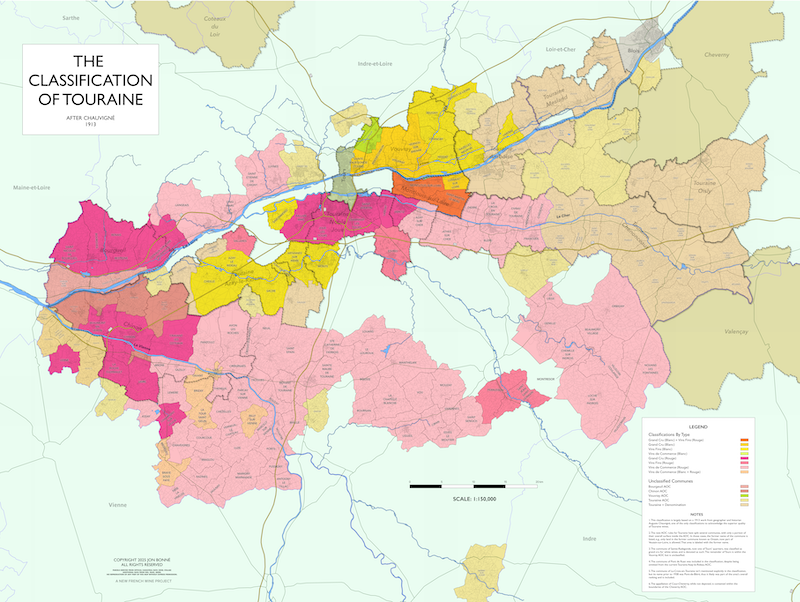
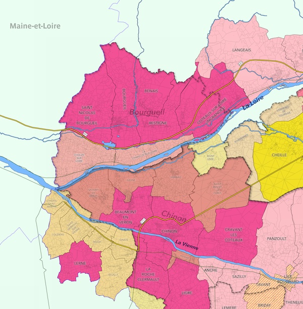
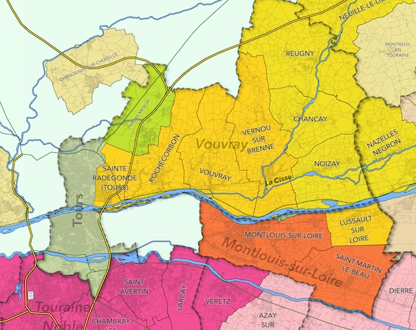
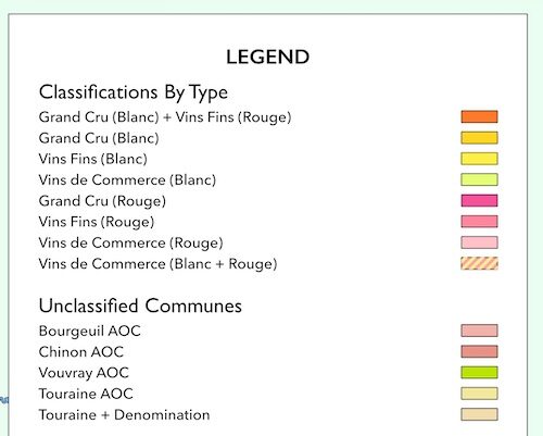
A sequel to the “Classification of Beaujolais” project, this full color 24″ x 18″ (61 x 45.7 cm) matte poster is printed on high-quality 120 lb. paper stock. It’s based on the classification made in 1913 by local historian and geographer Auguste Chauvigné, one of the only times that Touraine wines were accorded this level of attention — as high-quality wines worthy of ranking.
That timing is especially relevant — after the worst of phylloxera, before the AOC system, when the Loire like other regions was trying to understand its relative tiers of quality and its terroir. As such, you’ll see that top rankings were accorded some of the places we now know make exceptional wine, including parts of Chinon, Bourgeuil, Vouvray, and Montlouis. But Montlouis was also known for its red wines, and what are now the designations of Azay-le-Rideau and Touraine Noble Joué were also considered exceptional.
This map is the first of its kind, to acknowledge both current AOCs and the historic importance of the region, and is indispensible for those wishing to learn more about this important and often misunderstood region of France.
NOTE: Customers who buy the printed map can also get a digital copy for just $8. Digital copies will only be available to customers of the printed map.
ALSO NOTE: Any shipments outside the U.S. (including Canada) do not include customs fees to be paid by the receiver. This is meant to reduce total shipping costs, as pre-paid fees are typically much higher.
| Attributes | Value |
|---|---|
| Weight | 16 oz |
| Dimensions | 20 × 2.5 × 2.5 in |
You may also like…

Related products
-

“The Classification of Beaujolais” Map Poster
$65.00 -
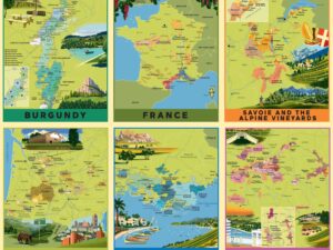
“The New French Wine” Map Poster Packs
$28.00 -
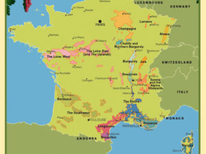
“The New French Wine” Map Poster: All France
Original price was: $36.00.$28.00Current price is: $28.00. -
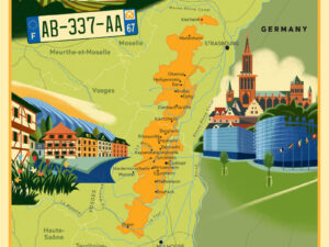
“The New French Wine” Map Poster: Alsace
Original price was: $36.00.$28.00Current price is: $28.00. -
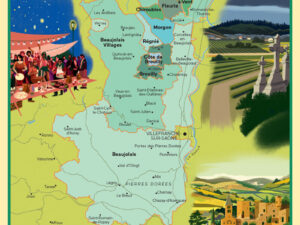
“The New French Wine” Map Poster: Beaujolais
Original price was: $36.00.$28.00Current price is: $28.00.